
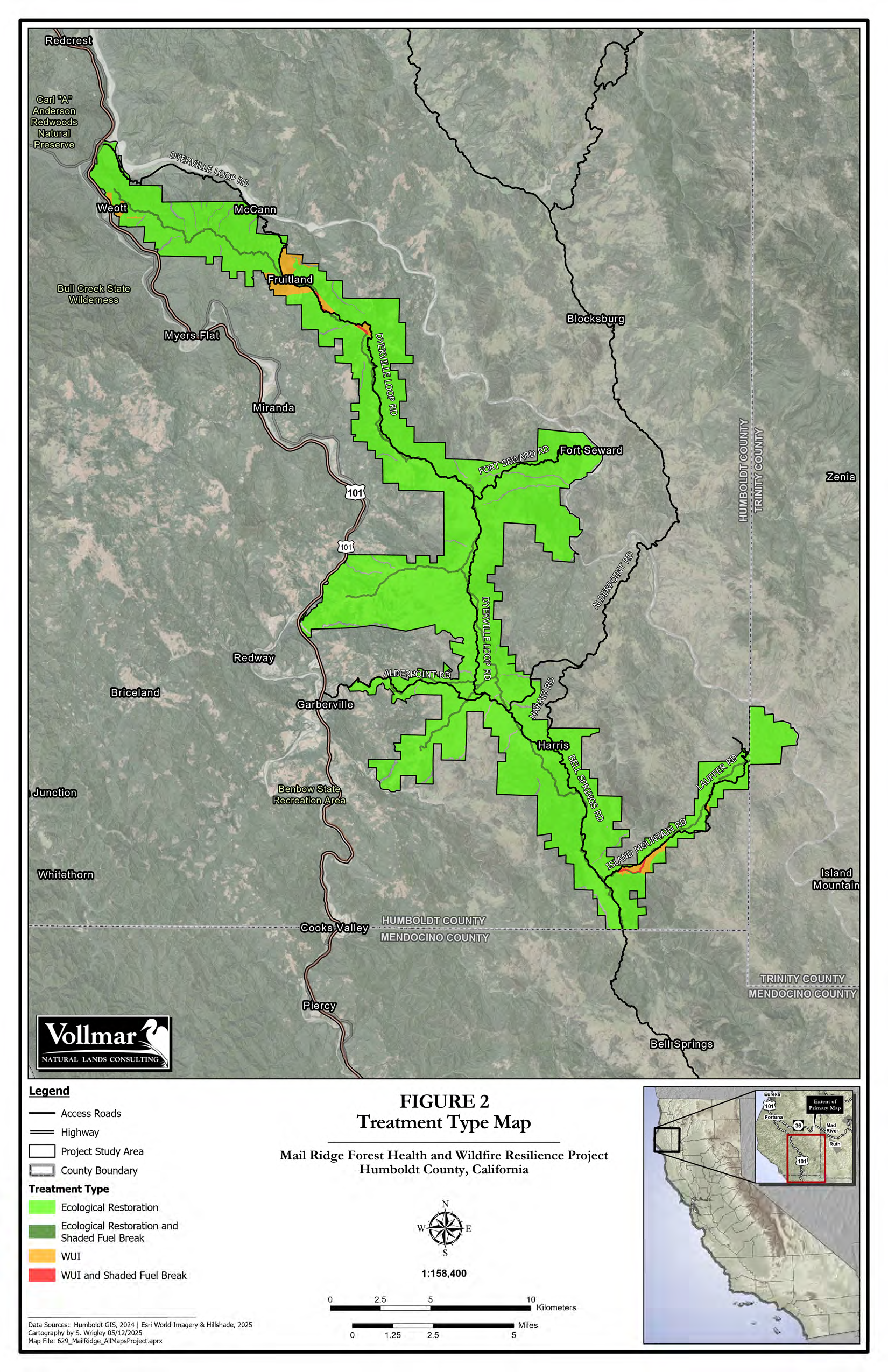
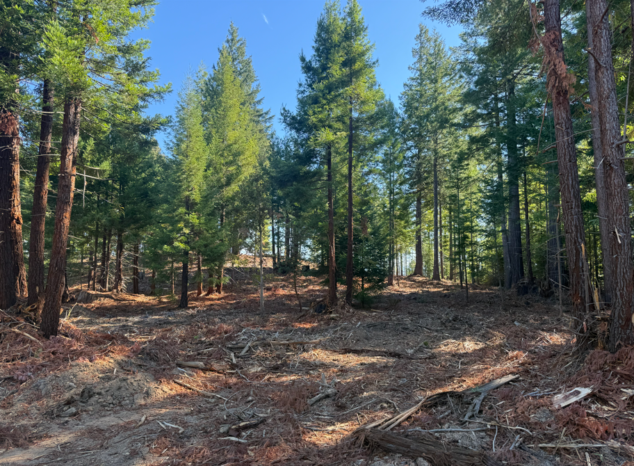
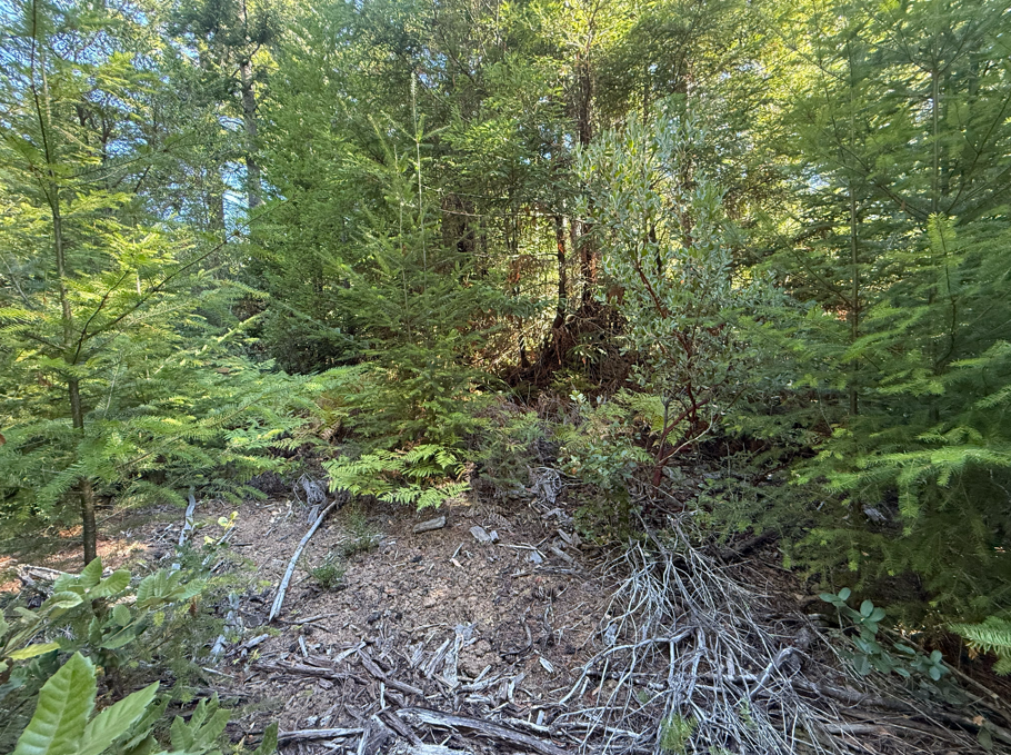
Today’s forests reflect prior generations’ management. Standing on a logging road along Mail Ridge (Map 1), a 180-degree turn reveals just how much those management decisions can shape a forest. On the right, Douglas-fir (Pseudotsuga menziesii), manzanita (Arctostaphylos spp.), and tanoak (Notholithocarpus densiflorus) form a dense understory under a coast redwood (Sequoia sempervirens), creating a nearly continuous wall of vegetation. On the left, much of this understory has been masticated, leaving a considerably more open forest (Figure 1). The forest on the right is what we inherited, shaped in part by decades of fire suppression that allowed burnable biomass, or fuels, to accumulate. The forest on the left is what we hope to leave behind. After a recent close call with catastrophic wildfires, landowners in Humboldt and Mendocino counties are working to ensure future generations inherit forests less susceptible to catastrophic fire than the ones they inherited.
The Mail Ridge Wildfire Resilience Project (MRWRP) aims to reduce the risk of catastrophic wildfires through strategic fuel reductions. The Humboldt County Resource Conservation District (HCRCD), which carries out this plan, must coordinate fuel reductions across a nearly 54-mile-long ridgeline called Mail Ridge. Navigating this ridgeline is already topographically challenging. Managing the 20,000 acres of land owned by multiple stakeholders adds another layer of complexity: balancing each stakeholder’s interests and desired outcomes against costs and the broader potential for risk reduction.
One stakeholder is the Humboldt Redwood Company (HRC), which owns over 200,000 acres of active redwood timberlands in the region. Three Yale Forestry students, along with attendees of the Northern California Wildfire Task Force Conference, toured about 200 acres of HRC property within the MRWRP project area. Under the direction of two HRC foresters and an HCRCD project manager, we got an inside look at how fuel reduction projects are carried out on private timberlands in California.
We quickly learned two things at the site: dense vegetation is everywhere, and removing biomass is very expensive. Coast redwoods are clonal, meaning they can regrow from their trunks or stumps after being cut or damaged, an adaptation to fire. Without fire, a thick understory combines with the redwoods to create a wall of biomass that gives new meaning to the word “thicket.” The MRWRP aims to reduce this thicket, mainly through prescribed burns, mastication, and hand thinning. The catch is that current treatment prices are around $1,500/ac, $3,000/ac, and $5,000/ac, respectively. At those prices, treating all 20,000 acres would be prohibitively expensive, so location and treatment type matter most.
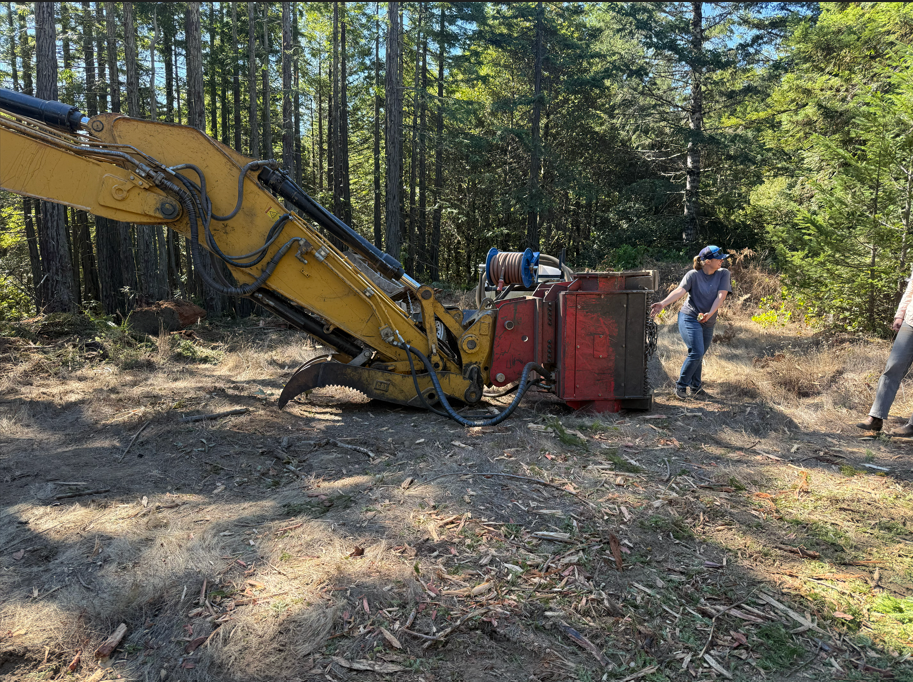
Because of these constraints, they strategically placed the resulting fuel breaks along the ridgeline to maximize fuel discontinuity while minimizing costs. We got a glimpse of the intricacies of mastication, seeing a harvester with a large mulching head attached (Figure 2). The machine was broken due to a hydraulic failure, which, if left untreated, could itself become a fire hazard. . It highlights the less obvious challenges of fuel reduction, where even a relatively straightforward task like removing vegetation depends on expensive machinery and constant maintenance.
The results of mastication were visible across a nearby hilltop (Figure 3), where much of the dense understory had been mulched, leaving a considerably more open forest. Unlike prescribed burning, mastication does not actually remove biomass from the landscape. Instead, it grinds vegetation into smaller pieces that remain on the forest floor. Although the fuels remain, reducing their vertical and horizontal continuity can help limit the potential for fire to spread into the canopy. The goal is not necessarily to stop a wildfire altogether, but to reduce its intensity and give firefighters a better chance of containing it. By concentrating these treatments along the ridgeline, the MRWRP hopes to achieve these benefits without treating every acre of forest.
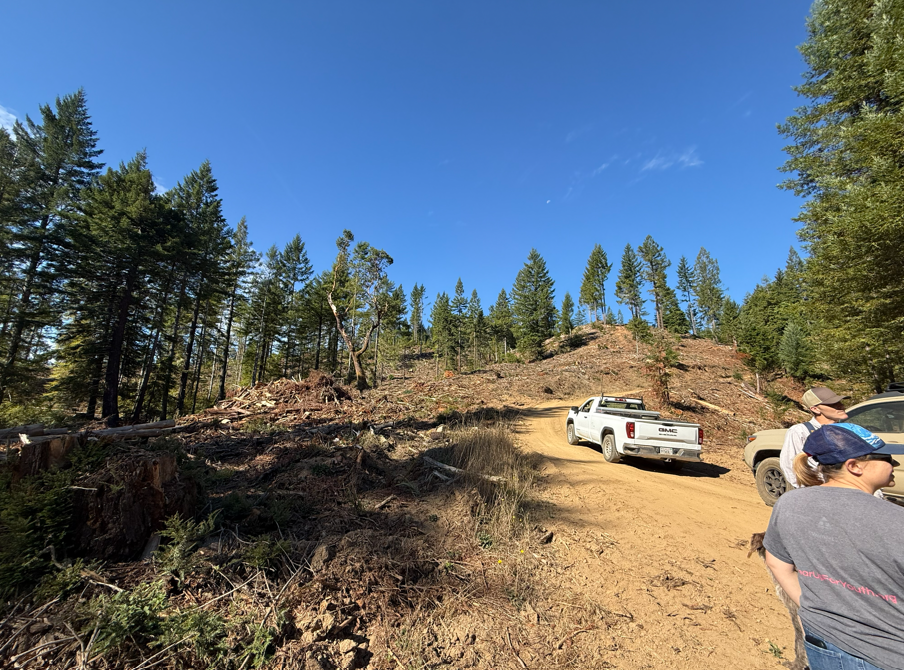
Of course, the 200 acres we toured represent only a small portion of the larger 20,000-acre MRWRP (Map 1). What initially seemed like a relatively simple task of removing vegetation turned out to require enormous planning, money, and coordination. Across the ridgeline, these individual treatments are intended to work together to reduce the risk of catastrophic wildfires. While a single fuel break cannot make a forest more resilient, a connected network of treatments can help make the landscape more resilient. The two sides of the logging road remind us of what is at stake. We inherited the forest on the right, but through projects like the MRWRP, we have the opportunity to leave future generations something closer to the forest on the left.
Andrew Saah – Andrew’s work focuses on applying Remote Sensing, LiDAR, and Geospatial Information Systems to natural resource and forest management, but he is always interested in environmentally related issues.
Catch up with Andrew on LinkedIn!
See Andrew’s personal website!