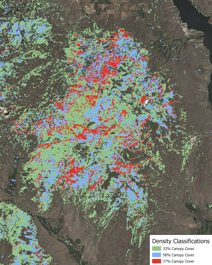
In partnership with the USDA Natural Resources Conservation Service and Pheasants Forever in Bozeman, MT, our research assistant used geospatial analysis and remote sensing to determine conifer density and potential encroachment in the Elkhorn Mountain region. Throughout western Montana there are forest communities which have not burned in decades. Lack of fire can lead to conifer encroachment of grasslands and increase fuel loads which heighten wildfire risks within these communities. This analysis located areas within the Elkhorn Mountains that are conifer dense and may need mechanical thinning to create more wildfire resilient communities. Potential treatment areas were prioritized based on current land use, conifer density, and species composition. Analysis using geospatial tools and remote sensing also identified forest areas previously treated and examined the efficacy of mechanical thinning to limit encroachment. In determining the efficacy of these treatments, this research better informed management decisions going forward.
COLLABORATORS
Natural Resources Conservation Service, Bozeman, MT
PROJECT DELIVERABLE
STUDENT RESEARCHER

William Weinberg, Research Assistant| William Weinberg is a Master of Forest Science candidate at Yale School of the Environment whose research focuses on agroforestry practices in the United States. Originally from the Mojave Desert, William went north to complete his Bachelor of Science degree in Forestry at Humboldt State University. His previous research has included physiological effects of pathogens on hardwood species, and energy allocation in masting tree species. Outside of academia, William enjoys baking, hiking, and reading. | Blog