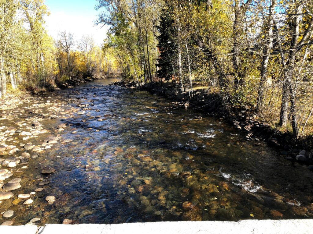
For a few hours every week, I get to escape the hustle and stress of graduate school and virtually explore the beautiful Stillwater Valley in rural south-central Montana, which is home to the Rosebud Creek, the subject of my Ucross High Plains Stewardship Initiative Research Project. In partnership with the Stillwater Valley Watershed Council and experienced hydrologist Tom Osborne, I am running a GIS analysis focusing on water quality and land use, with the goal of producing a portfolio of helpful GIS tools.
While I am the only Yale student involved in this project, Madhura Gurav, a recent graduate of the University of Pennsylvania’s Spatial Analytics and Hydrogeology Master’s Programs, is serving as an advisor. She has been a great technical resource the past few months, and has provided thoughtful input during every step of the research process. Not to mention, she has been a joy to work with, and has made some complex hours of GIS work more fun.
In early October, Madhura, Michelle, and I met virtually with Tom and Lindsey to learn about the Stillwater Valley watershed, and assess what we could produce that would be most useful for the Council. We landed on a slew of GIS maps and tools, which the Council will be able to distribute and share with local landowners. Because of his decades of experience in the field of hydrology and excellent knowledge of the region, Tom has been able to guide Madhura and me as we determine what data would be most impactful to analyze. In complement to Tom’s current project breaking down nutrient composition and water quality on various stretches of the Rosebud Creek, we are primarily looking at land use. Tom has recently uncovered historic nutrient load data, which we can also pair with historic land use, to paint a picture of the Rosebud Creek past and present.
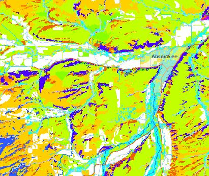
Madhura and I are deep in the weeds of the technical GIS component of the project. We are working through and analyzing various land cover combinations, using raster calculation tools to pinpoint change, and pulling corresponding Lidar imagery. In the New Year, our work will shift toward producing this project’s deliverables; a custom ArcGIS online data browser for the SVWC, a compelling story map discussing historic change and current quality of the Rosebud Creek, and a handful of static maps for regional distribution and landowner education. I am excited to continue working with Tom and Lindsey to tailor these products to suit the needs of the Council and the greater Rosebud Creek region!
Katherine Tucker, Research Assistant|Katherine is a Master of Environmental Management candidate at the Yale School of the Environment specializing in Water Resources Science and Management. A native of Woodstock, Vermont, Katherine decided to study watersheds after her community flooded during Tropical Storm Irene. She received her BA in Geography and History from Bucknell University, where she studied the environmental history of transboundary Vermont/Quebecois watersheds. Prior to Yale, Katherine worked as a GIS Technician for the City of Thornton, Colorado, and loved exploring the Rockies. She sees potential at the nexus of equitable community water management and citizen driven data science. A former Girl Scout Camp Counselor, she is passionate about encouraging young women to explore STEM careers. See what Katherine has been up to. | Blog