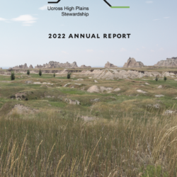
2022 Annual Report
Check our UHPSI’s newly released 2022 Annual Report! Read about student projects, impacts, and journeys from the past year.
Check our UHPSI’s newly released 2022 Annual Report! Read about student projects, impacts, and journeys from the past year.
It’s December here in New Haven, Connecticut. The leaves have all fallen, the grass is done growing, and the days are getting quite short. It also means that Christmas is right around the corner. I was having a conversation with friends the other day about Christmas movies. Afterward, I remembered one that hadn’t come up Read more about Beavers and Space—Sam Wilson[…]
Being a research assistant with the Ucross High Plains Stewardship Initiative at YSE has afforded me a variety of opportunities to expand my knowledge in the field of mesic restoration in the western United States. Focusing on a region that is highly susceptible to drought events creates an interesting challenge when tracking water availability. The Read more about Utilizing Geospatial Analysis to Increase Water Availability in the American West—Rowan Sharkey[…]
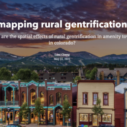
CLICK HERE TO VIEW LANI’S STORYMAP Rural gentrification is increasingly recognized as a significant problem for Western amenity towns in the U.S. as a result of rapid in-migration fueled by the desire for closer access to these amenities, expanded telework from the pandemic, and broader nation-wide socioeconomic trends. Corresponding social, economic, and political impacts include Read more about Mapping Rural Gentrification—Lani Chang[…]
Ryanna supported the Council for Watershed Health (CWH) in promoting integrated regional watershed management in the greater Los Angeles region. Her projects included supporting Watershed Coordinators with the Safe Clean Water Program, an initiative that captures and cleans stormwater while generating new opportunities for open space preservation. Ryanna also conducted water sampling and habitat monitoring Read more about Community-led water resilience in the Los Angeles River Watershed[…]
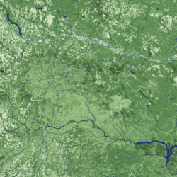
In partnership with the USDA Natural Resources Conservation Service and Pheasants Forever in Bozeman, MT, our research assistant used geospatial analysis and remote sensing to determine conifer density and potential encroachment in the Elkhorn Mountain region. Throughout western Montana there are forest communities which have not burned in decades. Lack of fire can lead to Read more about Elkhorn Mountain Conifer Density Survey[…]
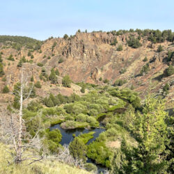
Our team worked to design and deploy a portfolio of GIS tools for the Stillwater Valley Watershed Council, focusing specifically on the Rosebud Creek. In its headwaters, the Rosebud Creek is a designated National Wild and Scenic River. Land use in the lower reaches of the Rosebud Creek’s riparian corridor has gradually transformed in the Read more about Stillwater-Rosebud Water Quality Initiative[…]
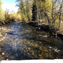
For a few hours every week, I get to escape the hustle and stress of graduate school and virtually explore the beautiful Stillwater Valley in rural south-central Montana, which is home to the Rosebud Creek, the subject of my Ucross High Plains Stewardship Initiative Research Project. In partnership with the Stillwater Valley Watershed Council and Read more about Work is Flowing for the Rosebud Creek Team—Katherine Tucker[…]